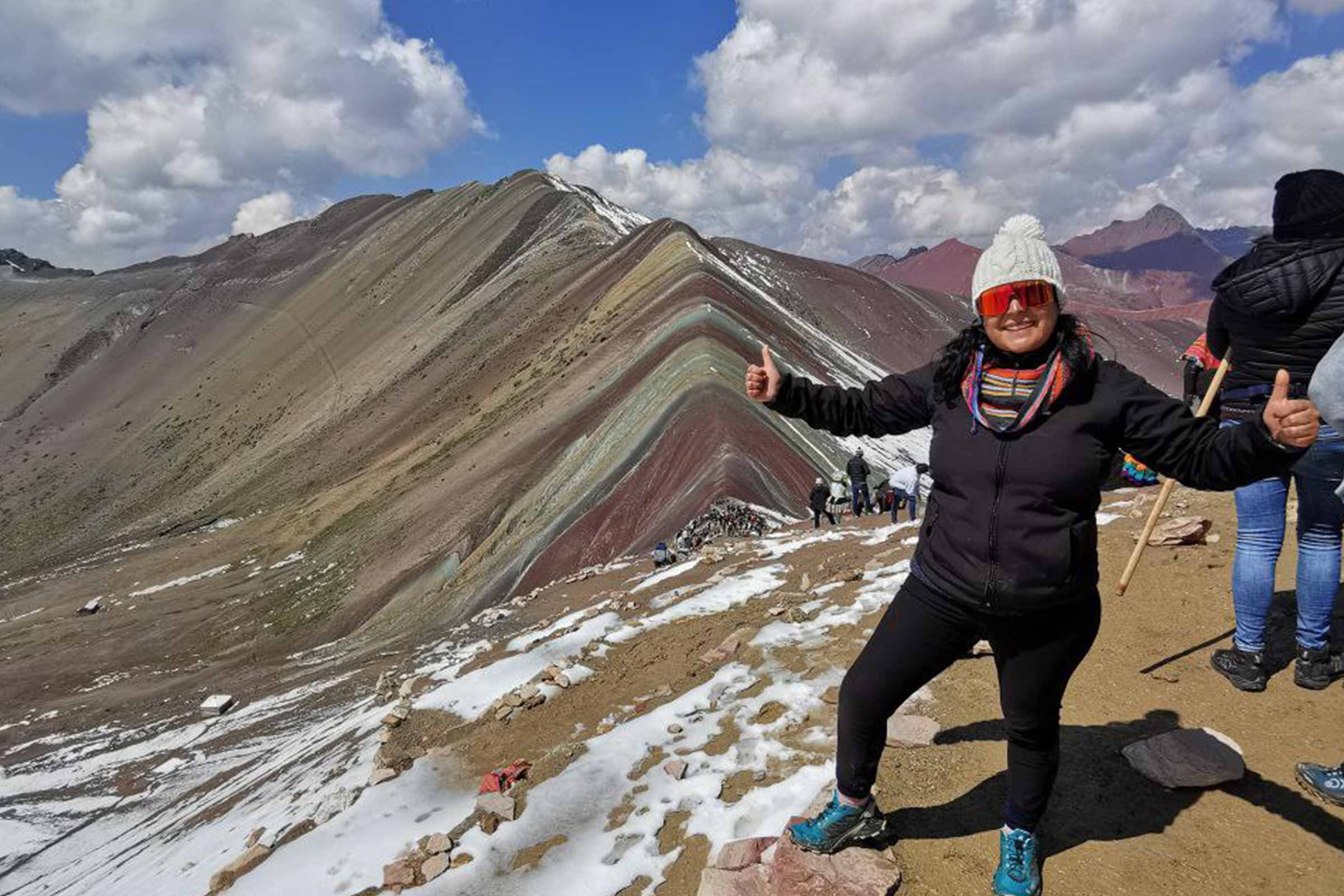
Rainbow Mountain (Vinicunca, or Winikunka in Quechua) is a striped mountain in the Vilcanota range of southern Peru, about 100 km (62 mi) southeast of Cusco, whose bands of red, pink, mustard, green and white are layers of mineral-rich sediment. The viewpoint everyone hikes to sits at 5,036 m (16,522 ft) according to Peru’s tourism ministry, MINCETUR, and most visitors reach it on a day trip from Cusco, with about 3 km (1.9 mi) of walking each way from a trailhead that is already above 4,500 m (14,760 ft). Below: the geology, the two roads in, the altitude, the season and who runs the entrance today.
- 5,036 m(16,522 ft) at the viewpoint, the official MINCETUR figure; the 5,200 m you often read refers to higher ground nearby.
- ≈3 km(1.9 mi) each way from the Cusipata-side trailhead: about 1 h 30 up and the same down.
- May–Octis the dry season, with the clearest skies; from November to April snow and cloud can hide the colors.
What is Rainbow Mountain, and why does it have colors?
In Peru it is called the Montaña de Siete Colores, the Seven Colors Mountain. According to Peru’s state news agency Andina, the Quechua name joins wini, the round, heavy black stones of the area, and kunka, neck, for the narrow pass.
The colors are not paint or a photo filter. The Geological Society of Peru, quoted by BBC Mundo in 2018 and by Andina in 2025, describes layers of sediment laid down by water in seas, lakes and rivers between roughly 65 and 2 million years ago. Tectonic movement lifted and tilted them, and humidity and erosion oxidized the minerals in each layer; iron oxides give the reddish tones.
| Color | What the layer is made of |
|---|---|
| Pink / fuchsia | Red clay, mud and sand |
| Red | Argillites (hardened clay) and clays |
| Purple / lavender | Marl (clay with calcium carbonate) and silicates |
| Green | Clays rich in iron and magnesium, with copper oxide |
| Mustard / gold | Limonite and calcareous sandstone with sulfide minerals |
| White / cream | Quartz sandstone and limestone |
Composition by color as explained by the Geological Society of Peru to BBC Mundo (May 28, 2018) and summarized by Andina (December 3, 2025).
“Seven colors” is a name more than a count. What you see depends on the light: the bands look strongest once the sun is up on a clear morning, and flatter under cloud or after fresh snow.
You will also read that a glacier covered Vinicunca until climate change melted it around 2015. The scientists BBC Mundo consulted were more careful: the Geophysical Institute of Peru said the hill was partly iced and had seasonal snow until the early 1990s, and a researcher at the Pontifical Catholic University of Peru doubted the summit had been a glacier in recent decades. What is certain is that visitors began arriving in early 2016; MINCETUR counts about 110,000 in 2025.
Where is Rainbow Mountain, and how do you get there from Cusco?
Vinicunca is in the Vilcanota range, close to Ausangate, which at 6,384 m (20,945 ft) is the highest mountain in the Cusco region. The mountain is shared by communities of two districts, Cusipata (Quispicanchi province) and Pitumarca (Canchis province), and each side has its own road and trailhead. Both start the same way: south from Cusco along the Vilcanota valley, on the road toward Puno.
| Cusipata side (Chillihuani) | Pitumarca side (Pampachiri) | |
|---|---|---|
| Road from Cusco | To Cusipata, then up through Chillihuani and the Llaqto area | Through Checacupe and Pitumarca to the Kayrahuiri parking area |
| Drive time | ≈1 h 30 to Cusipata, 30 min to Chillihuani, then ≈20 min on a dirt road | About 3 hours |
| Way up | On foot, ≈3 km (1.9 mi) and ≈1 h 30; horses for hire | On foot or by horse; this is also the ATV route |
| Our tour | Rainbow Mountain Full Day, from US$45 | Rainbow Mountain by ATV, from US$80 |
Cusipata-side times from our tour itinerary; Pitumarca-side drive time from Andina (December 2025). Both start before dawn.
Our full-day hike uses the Cusipata side, with hotel pickup at 4:30–5:00 am and return to Cusco in the late afternoon; guide, meals and entrance are included. Dates and booking are on the Rainbow Mountain tour page.
Without a tour, interprovincial buses heading south stop in Cusipata and Checacupe, but no regular service climbs the dirt roads to the trailheads: you would need a hired local car before dawn and cash for the community fee.
How high is Rainbow Mountain? 5,036 m vs. 5,200 m
The viewpoint where everyone stops for the photo is at 5,036 m (16,522 ft). That is the figure in the tourism inventory of MINCETUR, Peru’s Ministry of Foreign Trade and Tourism, and the elevation PeakVisor lists for Winikunka. The 5,200 m (17,060 ft) repeated by Wikipedia, many tour pages and Andina refers to higher ground nearby that the trail does not reach. To judge how your body will cope, use 5,036 m: that is where you will stand.
| Place | Altitude | Note |
|---|---|---|
| Ausangate summit | 6,384 m / 20,945 ft | The snow peak you see from the trail |
| Higher ground nearby | ≈5,200 m / 17,060 ft | The figure many websites quote; not on the trail |
| Rainbow Mountain viewpoint | 5,036 m / 16,522 ft | Official MINCETUR figure; where the hike ends |
| Trailhead (Cusipata side) | Above 4,500 m / 14,760 ft | You start higher than any pass on the Inca Trail |
| Warmiwañusca, Classic Inca Trail | 4,215 m / 13,829 ft | 821 m (2,690 ft) lower than the viewpoint |
| Cusco | 3,400 m / 11,155 ft | 1,636 m (5,367 ft) lower than the viewpoint |
Viewpoint: MINCETUR. 5,200 m and Ausangate: Andina. Trailhead: approximate, from our tour.
Put simply, you step out of the van higher than Dead Woman’s Pass, the top of the Classic Inca Trail (see how hard the Inca Trail is), and then walk uphill for an hour and a half.
The hike, the Red Valley and easier ways up
From the Cusipata-side trailhead the path is about 3 km (1.9 mi) each way: around 1 h 30 up and about the same down. The first part crosses high pasture with llamas and alpacas and, on clear days, Ausangate’s snowfields in view; the last stretch to the viewpoint is the steepest part of the day. Walk at a pace that still lets you talk. On the way down, trekking poles help on the loose sections. The viewpoint is busiest from about 9 to 11 am, so the earlier you start, the more space you get.
The Red Valley
From the ridge beside the viewpoint you look down into the Red Valley (Valle Rojo), a valley of rust-red slopes. Walking into it is a separate visit on community land, with its own fee (not included in our tour) and more walking at very high altitude. Decide on the day with your guide.
Horse, ATV or a gentler mountain
- Horse: local families rent horses on the trail for most of the way up; the final stretch is on foot. Agree the price first and pay in cash (not included in our tour).
- ATV: on the Pitumarca side, our Rainbow Mountain by ATV tour replaces part of the approach with a quad bike: about 20 minutes of practice, a slow 30-minute ride up and about 40 minutes at the top. From US$80, entrance included.
- Another colored mountain: if the altitude or the effort worries you most, Palcoyo (from US$45) has a much gentler walk. We compare the options in Rainbow Mountain vs Palcoyo vs Pallay Punchu; the newest has its own Pallay Punchu guide.
Best time to visit and the weather
According to Andina, the best months are May to October, when there is little rain and the sky is clear. From November to April it is the rainy season, and snow can cover the peaks, hide the colors and even block access. Whatever the month, nights and early mornings are below freezing up here, and the sun is strong at 5,000 m even when the air is cold.
| Months | What to expect | What it means for you |
|---|---|---|
| May to October | Dry season: clear skies, frost at dawn, the strongest colors once the sun is up | The best time; take the earliest start you can |
| November and April | The rainy season begins or ends: more cloud and showers | Usually workable; pack rain gear |
| December to March | The wettest months: cloud, hail, sometimes snow, muddy paths | Tours run, but seeing the colors is a gamble |
Seasons from Andina (December 2025) and our guides’ experience on the trail.
Entrance fee and who manages the mountain (October 2026)
Access to Vinicunca is not run by a national authority but by the local communities whose land the trail crosses, which is why the rules have changed several times. MINCETUR’s inventory lists the entrance at S/30 for foreign adults. Our full-day and ATV tours include it; the Red Valley fee is separate.
| Date | What happened |
|---|---|
| November 2023 | The Cusipata access closed over a dispute between communities about who should manage it. |
| July 16, 2024 | Reopened under a truce while talks continued; visitors entering through Cusipata did so free of charge. |
| August 2024 | Entry control was back on the agenda, and fees were raised. |
| March 2026 | The parties agreed to create a Transitional Tourism Committee to manage the site. |
| June 29, 2026 | A commission of the Chillihuani community and the Llaqto sector took over fee collection temporarily, until the committee is entered in the Public Registry. |
Sources: Andina (July 18, 2024) and Peru’s Presidency of the Council of Ministers via Andina (June 29, 2026). Status as of October 15, 2026.
In practice, the amount and the collection point can change at short notice. On your own, carry soles in cash; with us, we confirm access before every departure.
Altitude and safety: how to prepare
The CDC’s high-altitude guidance is mostly about where you sleep, and on a day trip you sleep back in Cusco. But you spend hours more than 1,600 m (5,250 ft) above the city. The CDC lists headache as the main symptom of altitude sickness, usually with loss of appetite, dizziness, fatigue or nausea, starting 2 to 12 hours after going up, so it can appear on the drive back. Symptoms usually improve with a descent of at least 300 m (1,000 ft); on this hike, that means turning back.
- Do the hike on your third day in the region or later; we recommend at least 2–3 days in Cusco first. The CDC suggests one or two nights lower than Cusco on arrival, which the Sacred Valley makes easy.
- Eat a light breakfast, drink water and walk slowly from the very first step.
- Tell your guide at once if you have a strong headache, nausea or dizziness. Our guides carry emergency oxygen and a medical kit.
- If you have a heart or lung condition, are pregnant or have had altitude sickness before, ask your doctor before you book.
If you are also hiking to Machu Picchu, Rainbow Mountain makes a good test before the Inca Trail; just leave a rest day in between. Our guide to altitude sickness on the Inca Trail explains what the CDC recommends in more detail.
What to bring: rain jacket or poncho and rain pants, winter hat and gloves, warm layers, sunscreen (SPF 35+), sunglasses, water, snacks, spare camera batteries, trekking poles and soles in small notes.
Frequently asked questions
Where is Rainbow Mountain in Peru?
How high is Rainbow Mountain?
How long is the Rainbow Mountain hike?
Why is Rainbow Mountain colored?
Can I visit Rainbow Mountain without a tour?
Is Rainbow Mountain open in 2026?
Is the entrance fee included in the tour?
Can you ride a horse to the top?

About the author
Raquel Sánchez co-founded Terra Quechua Peru in Cusco in 2012 together with Edwin Medina, both with extensive trekking experience. She writes our Inca Trail guides from the day-to-day work of securing permits and organizing every departure with our guides, cooks and porters.